Astrocartography Accuracy: How Exact Is This Map?
Here is how each line is calculated, what our tests found, and how a city earns its place, with the numbers left in.
How it works
Enter your exact birth time
The time zone and historical daylight saving rules are converted for you, so the time you enter is what sets the accuracy of your map.Choose a drawing method
In mundo is the default. Switch to Zodiacal to compare; the gap ranges from nothing for the Sun to over 1,000 km for Pluto.Check the numbers for one place
Tap a city to see the distance to each line, then use the formula below to see how those distances feed its ranking.
Astrocartography accuracy has two parts. The position of a line is astronomy, and it can be tested: compared with Swiss Ephemeris across 3,001 moments, 52 lines and 7 cities, our map's line distances differed by at most 0.633 km. The meaning of a line is a symbolic tradition, without scientific evidence. In practice, the largest errors come from the birth time, not the calculation: four minutes moves a line by about 111 km at the equator.
From birth details to a line
- Birth moment. Your local birth time is converted to universal time using the time zone history of your birthplace, including past daylight saving rules.
- Positions in the sky. Planet positions come from astronomy-engine, an open astronomy library, with corrections from NASA JPL Horizons data for the Earth, Jupiter, Saturn, Uranus and Neptune; Pluto and Chiron come straight from JPL Horizons tables.
- Four lines per body. For each of the 12 bodies, the map finds where on Earth it was rising, setting, at its highest point and at its lowest point at that moment. The Earth is treated as a sphere.
- Distance to a place. The distance from a city to a line is the shortest great-circle distance, the route you would measure on a globe.
What our tests found
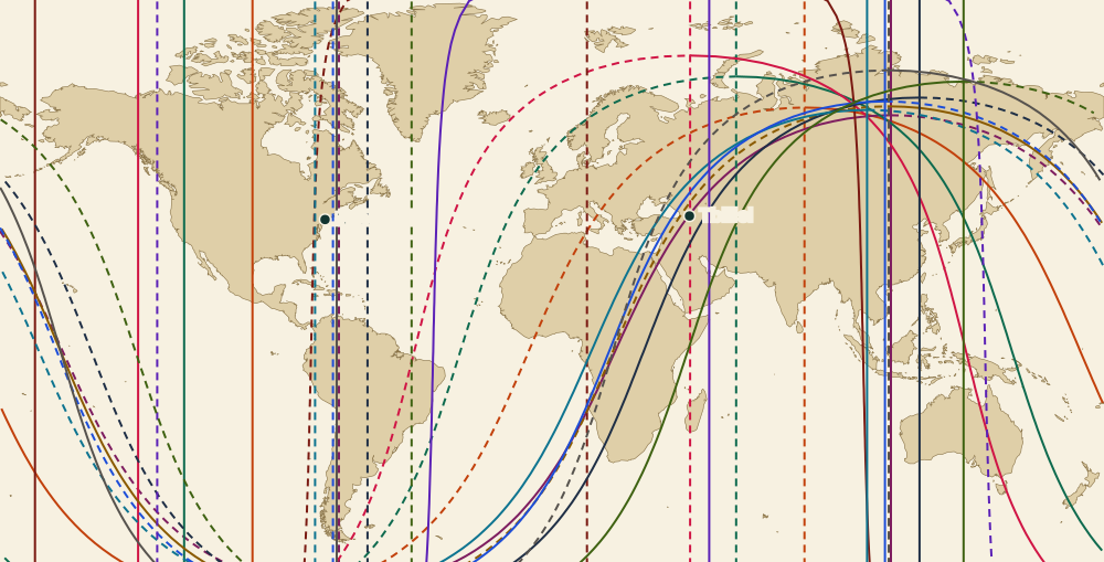
We compared results with Swiss Ephemeris, a standard reference in astrology software, in a test run dated November 7, 2026.
| Test | Size | Result |
|---|---|---|
| Distance from a city to a map line | 3,001 moments, 52 lines (our 48 plus the four for the mean node, which the map does not draw), 7 cities | Largest difference 0.633 km |
| Sun through Pluto falling in the right zodiac sign | 24,002 moments | No wrong signs |
| True North Node falling in the right zodiac sign | 24,002 moments | One wrong sign, in 2066, right on a sign boundary |
That 0.633 km is far smaller than a city. Agreement with a reference does not prove a line means anything, though. It shows only that the astronomy is computed correctly.
What actually moves your lines
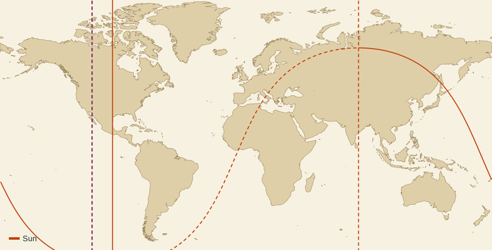
Here are the things that change a line, biggest effect first in everyday use.
- Birth time. The Earth turns one degree every four minutes, and one degree is about 111 km at the equator. A birth time rounded by 15 minutes can move every line by nearly four times that.
- Time zone errors. Older birth years often used different daylight saving rules, and a one-hour slip moves everything. For Maya, born in New York at 2:30 pm on June 10, 1990, moving the time one hour later, to 3:30 pm, changes the first city from Tbilisi to Istanbul.
- Drawing method. In mundo follows the body's real position in the sky. Zodiacal uses only its degree along the zodiac. On our sample map the gap is none for the Sun and the North Node, usually under about 300 km for the Moon through Mars, and more than 1,000 km in places for Pluto.
- The calculation itself. On the test above, at most 0.633 km.
When two sites disagree, check those in order. Most of the time, you will find the cause in the first three.
How a city gets its score
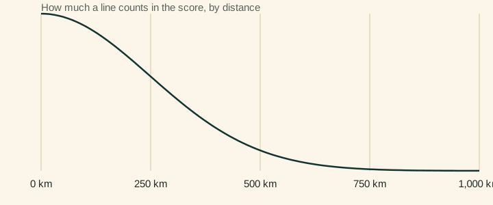
For each goal, the score adds up every line within 1,000 km of the city. Each line's score is:
body weight × angle weight × distance fade
Distance fade is exp(-(km/350)²). In plain terms, a line through the city counts in full, and it fades quickly as you move away.
| Distance | Share counted |
|---|---|
| 0 km | 100% |
| 100 km | 92% |
| 175 km | 78% |
| 350 km | 37% |
| 700 km | 2% |
| Over 1,000 km | Not counted |
Body weights
| Body | Love | Career | Home |
|---|---|---|---|
| Sun | 0.3 | 0.8 | 0.3 |
| Moon | 0.5 | 0.1 | 1 |
| Mercury | 0.1 | 0.45 | 0.1 |
| Venus | 1 | 0.2 | 0.6 |
| Mars | 0.25 | 0.4 | -0.6 |
| Jupiter | 0.45 | 1 | 0.7 |
| Saturn | -0.6 | 0.35 | -0.4 |
| Uranus | -0.2 | 0.1 | -0.5 |
| Neptune | -0.2 | -0.2 | -0.25 |
| Pluto | -0.5 | -0.1 | -0.6 |
| North Node | 0.2 | 0.25 | 0.15 |
| Chiron | -0.2 | -0.15 | -0.2 |
Angle weights
| Line | Love | Career | Home |
|---|---|---|---|
| Rising (AS) | 1 | 0.8 | 0.8 |
| Setting (DS) | 1.2 | 0.5 | 0.6 |
| Overhead (MC) | 0.5 | 1.3 | 0.3 |
| Underfoot (IC) | 0.7 | 0.3 | 1.3 |
The balanced goal is the average of love, career and home. When sorting, each city also gets a small lift for being well known, at most 0.6, based on how many languages have a name for it. That keeps first places among cities people really consider.
These weights are our own, set by us with astrological tradition as the guide. They are not measurements, and a different astrologer could reasonably choose others. We publish them so you can disagree with specifics.
A worked score
Maya's love score for Tbilisi, first three lines:
- Venus underfoot, 18 km: 1 × 0.7 × 0.997 = 0.70
- Moon rising, 22 km: 0.5 × 1 × 0.996 = 0.50
- Jupiter setting, 214 km: 0.45 × 1.2 × 0.688 = 0.37
Five further lines between 377 km and 745 km take a little away, and the eight together come to 1.28.
Which cities get ranked
City data comes from GeoNames, licensed under CC BY 4.0, with about 226,000 places. Candidates for the rankings number about 400: big or widely known cities and a list of long-stay destinations. Places under the US State Department's top advisory, Level 4 (data of November 7, 2026), and Western Sahara are left out. Of two cities less than 250 km apart, only the higher one stays, and a country holds at most two. Above 62° latitude, only capitals are candidates. A city must also score above zero for a goal, before the small fame lift, to make that goal's list. You can still look up any place in the database by hand.
Time ranges and parans. In Map options you can say how sure you are of your birth time. The bands shift each line east and west by the turn of the Earth over that time, 15° an hour, and ignore the slow movement of the planets themselves. Parans are the latitudes where two highlighted planets reach their lines at the same moment. We solve for the latitude from each planet's position and test that the two lines really meet there.
What a line can and cannot prove
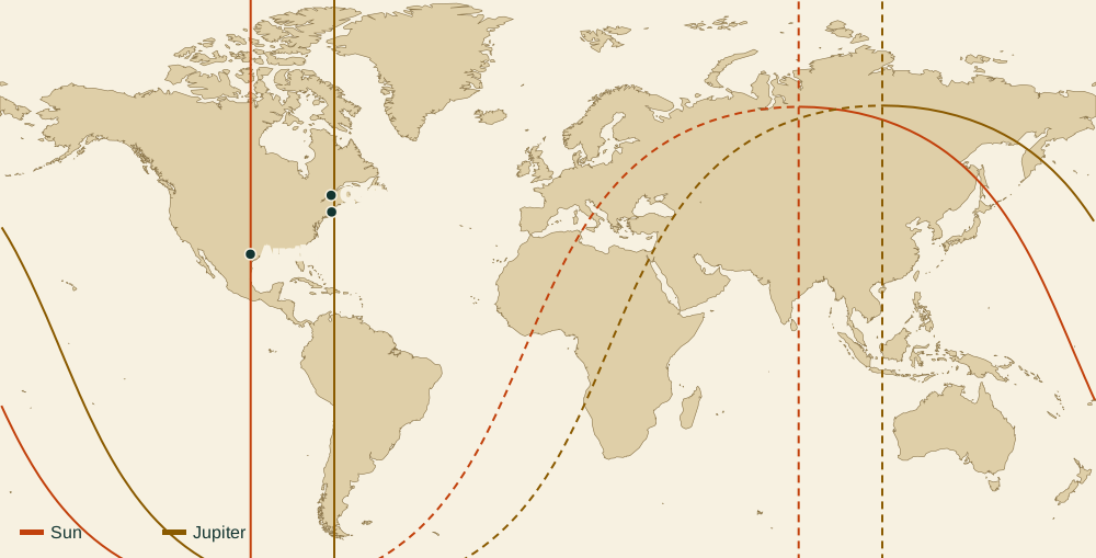
The calculation is astronomy. The meanings are a symbolic tradition, and nothing scientific shows that living near a line changes anything in your life. We write "astrologers connect this with" because that is exactly what we can stand behind. Use the map as a prompt for thinking about places, and judge the result against your own experience.
FAQ
Is astrocartography real or scientific?
The lines are real astronomy: a body truly was rising, setting, or at its highest or lowest point at those places at that moment. The meanings given to the lines come from a symbolic tradition, with no scientific evidence behind them. It is fair to enjoy the map as a way of thinking about places.
Which astrocartography chart is the most accurate?
With the same settings, calculations should agree closely, as ours matched Swiss Ephemeris to within 0.633 km. Bigger gaps come from birth time, time zone handling and drawing method. So the most accurate chart is usually the one with the most accurate birth time.
Why do maps differ between sites?
Check the birth time and time zone first, including old daylight saving rules. Then check the drawing method, because in mundo and Zodiacal drawings can sit anywhere from nothing to over 1,000 km apart, depending on the body. The calculation itself accounts for much less. Match all three settings before comparing two sites' maps.
Which is right, in mundo or Zodiacal?
Both are in use, and neither is wrong. In mundo follows the body's real position in the sky, and Zodiacal uses only its zodiac degree. This map defaults to in mundo and lets you switch. Stick with one method when you are comparing places.
How accurate is the map without a birth time?
Without a time, the drawing uses 12 noon local time and works only as an illustration, so it gives no city rankings. Each four minutes between noon and your real birth time shifts things by roughly 111 km at the equator.
Why publish the weights?
A ranking you cannot inspect is hard to trust. The weights are our own judgement, based on astrological tradition, and we would rather you see them and disagree than take a city name on faith. The formula above lets you work out any score yourself.
Related tools
Sites Compared
We read the public pages of five astrocartography sites on November 7, 2026, and set what each offers for free next to our own.
How to Read Your Map
Draw your own map above, then follow five steps that turn a tangle of lines into a plain reading of any one place.
Line Meanings
Every line is a pairing of one body and one angle, and this page explains both halves, with examples from a real map.
City Report
The city report takes the map you draw for free and adds the top-20 lists, what the lines near each city mean, and your rising sign in each one.
Love Map
Enter your birth details and the map sorts itself by the lines astrologers tie to affection, so you do not need to know what any line means.
Where Should I Live
Enter your birth date, time and place, and the map names the city your lines point to first, with the reasons behind it.
Relocation Chart
Add your birth details and a city to see your rising sign, Midheaven and planet houses redrawn for that place.
Rising Sign Calculator
Enter your birth details to get your rising sign, then pick any city to see the rising sign your chart would have there.